Current Exhibitions
Oblique Views: Archaeology, Photography, and Time
Oct 25, 2015 — May 7, 2017
For the first time in Oblique Views: Archaeology, Photography, and Time, large prints of Heisey’s stunning images will be paired directly with the Lindberghs’. The exhibition opens October 25, 2015 and runs through May 7, 2017 at the Museum of Indian Arts and Culture.
During 2007 and 2008, flying at alarmingly low altitudes and slow speeds, Adriel Heisey leaned out the door of his light plane, and holding his camera with both hands, re-photographed some of the Southwest’s most significant archaeological sites that Charles Lindbergh and his new bride Anne photographed in 1929.
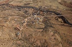
Galisteo
Galisteo is now considered statistically part of the Santa Fe metropolitan area, although it is still remote and has a population of less than three hundred people. It is home to a number of well-known artists and scholars, as well as families traditionally linked to the area, none of whom farm on the scale of the past. Galisteo Creek no longer washes away vegetation in the streambed, which now appears to be a lush forested strip. The church and cemeteries remain, as does the layout of the colonial village. Traces of the old narrow fields can still be seen. Photograph by Adriel Heisey, 2015.
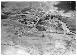
Galisteo
The village of Galisteo, south of Santa Fe, was established sometime between 1790 and 1816. Prior to the Pueblo Revolt of 1680, perhaps as many as fifteen thousand people lived in a number of very large pueblos in the Galisteo Basin. When the Spanish returned in 1692, the Pueblo Indians left basin communities and joined other pueblos, mostly along the Rio Grande. Sustained colonial use of the basin, beyond the early missions at the pueblos, started in the late 1700s with livestock grazing and the establishment of a military outpost. By 1929 Galisteo Creek was being used to irrigate farmed fields, some of which were laid out in the Spanish fashion in long narrow strips. Two fenced cemeteries can be seen to the left, and the road encircles the church in the center of the photograph—a building that was probably also the center of the village. Photograph by Charles A. and Anne Morrow Lindbergh, 1929.
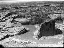
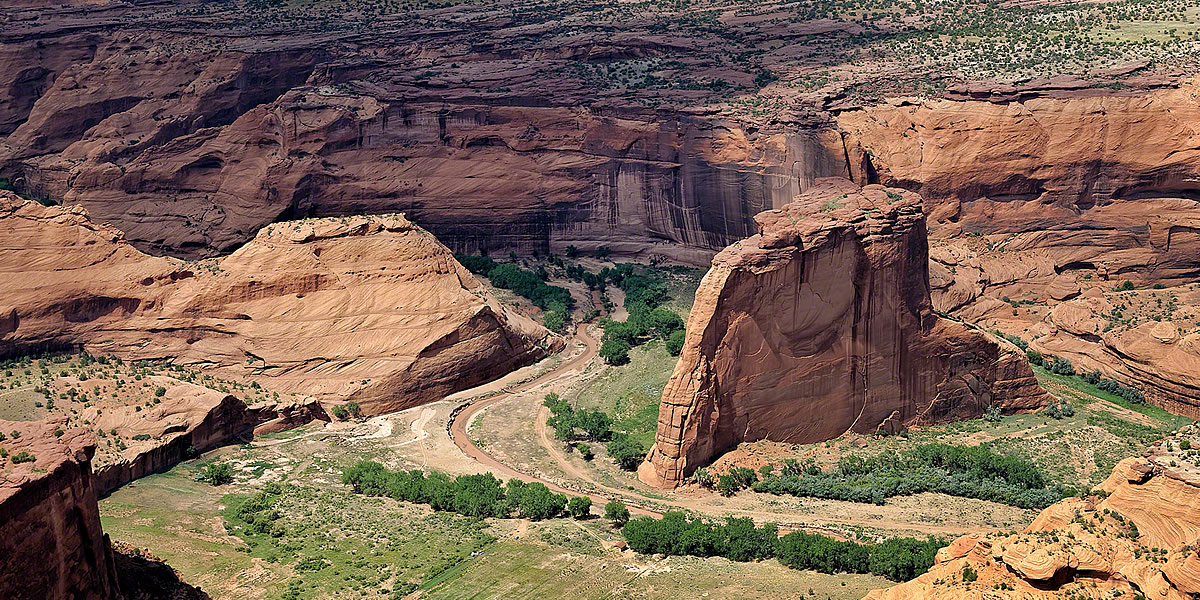
White House Ruin
White House Ruin is composed of two parts: a larger room block on the canyon floor that rose to four stories high in the back, and another set of rooms built in a rock shelter immediately above. The upper rooms could have been reached from the fourth-story roof of the lower structure. The bulging, stained walls of the rock face above the rock shelter have made the site a favorite photographic subject. Timothy O’Sullivan photographed the site in the mid-1870s, and it has been well photographed ever since, including by Ansel Adams. Photograph by Charles A. and Anne Morrow Lindbergh, 1929.
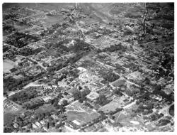
Santa Fe
Even in 1929, Santa Fe was an art center, the state capital, and a historic community. It was still a town rather than a city, however, and agricultural fields can be seen not far from the Plaza (approximately at the center of the photo), the heart of the social and economic life of the town. The old capitol building can be seen surrounded by trees in the upper center. Trees also mark the Santa Fe River, which forms a wandering diagonal from lower left to upper right. North is to the right in this photograph. Photograph by Charles A. and Anne Morrow Lindbergh, 1929.